ENGLISH:
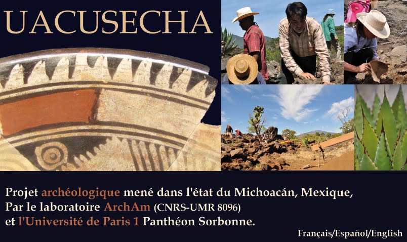
Since 2008, new archaeological investigations are leaded in the urban settlements of the Malpaís of Zacapu, in the center-north of the state of Michoacán, western Mexico. The main objective of this study is to understand, trough the urban organization and the use of urban space, a part of the social and political processes of the early Tarascan state.
Since 2008, new archaeological investigations are leaded in the urban settlements of the Malpaís of Zacapu, in the center-north of the state of Michoacán, western Mexico. The main objective of this study is to understand, trough the urban organization and the use of urban space, a part of the social and political processes of the early Tarascan state.
The region of Zacapu was, as documented by ethnohistory, the place where the Uacúsecha, a supposedly nomad warrior group, entered Michoacán from the north, before creating, in a large sociopolitical process of crescent complexity and conquests, what we know as the Tarascan state or kingdom. The Tarascans formed certainly one of the most original civilizations of Ancient Mexico. They had (and still have) an original language, a specific material culture, a strong centralization of power and society, an economic strength due to their access to the great resources of the Pacific coast and are one of the only holders of metallurgy craft production. They had to resist the Aztec Empire expansion on their eastern frontier, what they did with clear success, becoming one of the more powerful states of the Postclassic Mesoamerican time (1200-1521 A.D.). The Tarascan specialists tried in previous studies to understand the different dimensions of that important entity, through comprehensive studies of their territory control policies, tribute system (they controlled various submitted people), exchanges and commercial dynamics. The research team from Colorado State University or Michigan State University, deal with settlement pattern and ancient environment within the Patzcuaro Lake’s capital zone. But the processes that lead, from the beginning of 13th century, a group of warriors to conquer that territory and install the strong dynasty of the king Tariacuri, in the name of their tutelary god Curicaueri, are less investigated. A lack of knowledge still appears in some points, even after the large Michoacán Project conducted in the 1980’s and 1990’s, in the Zacapu region, by the French team of the Center for Mexican and central-America studies (CEMCA), composed by D. Michelet, G. Pereira, B. Faugère and V. Darras, among others. That is what my Ph. D. research will search to complete and explore, from a new perspective and with new tools the key area of Zacapu, in the center-north of Michoacán.
Twenty-two archeological sites were found in the Malpaís of Zacapu, four of them appearing like major urban settlements (occupied during Milpillas phase, 1200-1450 AD) and the place of living of a very dense and numerous populations. Those four important sites are the basis of the study, forming a very large corpus of urban frame, with a good conservation of the archaeological remains.
This new study pretends to identify the social organization at those settlements in order to understand a part of the sociopolitical process of Tarascan state formation. And with a new perspective: if material features (ceramic, lithic, architectural remains) are not the good clues to social categorization comprehension (that’s what previous studies lets appear), an analysis of space use and urban dynamics will, maybe, offer us better criteria of population social ordering. In any case, the sites that I’m studying must show the first signs of the hierarchical relationships that existed in the late Tarascan state. The necessity of obtaining a new corpus of spatial data is therefore a priority. Past field research consisted of mapping the site of the Malpaís Prieto, located on the latest lava flow forming the volcanic complex of the Malpaís of Zacapu. In the course of two field seasons (funded by the University of Paris 1, the CNRS laboratory and the French Ministry of External Affairs), 44 hectares of dense urban settlement (actually the complete site) were mapped and close to 1,500 architectural structures were registered. A new mapping protocol was applied, supporting by a Global Positioning System (GPS) methodology and aerial photographs, which allowed covering large surface and creating a precise map of the spatial structure of the site, in a short time. By identifying the spaces and structures linked to each residential and public unit, we got a good idea of the global use of spaces. One of the most interesting preliminary results is clearly the apparition of some large elite residencies located in specific neighborhoods, a first step to geographic status differentiation. A lot of analysis and tests are still to be done and will be conducted during the survey and excavation campaigns of the first months of 2010. After testing the mapping system on one site, the point is to precise the transversal study of the four sites forming the Malpaís of Zacapu urban complex, in order to understand the whole phenomenon of pre-Tarascan state formation in that area.
FRANÇAIS:
Depuis 2008, un nouveau projet de recherche est mené dans les établissements urbains du Malpaís de Zacapu, situé dans le centre-nord de l’Etat du Michoacán, dans l’ouest du Mexique. L’objectif central de cette étude est de comprendre, à travers l’organisation urbaine et l’utilisation de cet espace urbain, une partie des processus sociaux et politiques des débuts de l’Etat tarasque.FRANÇAIS:
La région de Zacapu fut, comme nous en informe l’ethnohistoire, le lieu d’arrivée des Uacusecha, un groupe de guerriers, supposé nomade. Cet événement précède la création, suite à long processus de complexification sociopolitique et de conquêtes, de ce que l’on connait mieux sous le nom d’Etat ou de royaume tarasque.
Les tarasques formaient l’une des civilisations les plus originales du Mexique Ancien. Ils possédaient une langue originale, une culture matérielle très spécifique, une forte centralisation du pouvoir et de la société et une force économique liée à leur accès aux ressources de la côte pacifique. Les tarasques étaient de plus l’une des rares cultures mésoaméricaines à posséder une production métallurgique. Ils résistèrent avec succès aux tentatives de conquêtes aztèques sur leur frontière Est, devenant ainsi, l’un des états les plus puissants de la Mésoamérique postclassique (1200-1521 apr. J.-C.).
Les spécialistes des tarasques tentent depuis longtemps de comprendre les différentes dimensions de cette importante entité, par l’observation de leur politique de contrôle territorial (système tributaire), ou de leurs dynamiques d’échanges et de commerce.
Des équipes de Colorado State University et de Michigan State University travaillent actuellement sur le patron d’établissement et sur la reconstitution du contexte environnemental de la zona-capitale du lac de Patzcuaro. Mais la question des processus qui, dans la première moitié du 13ème siècle de notre ère, menèrent un groupe de guerriers à conquérir ce territoire et mettre en place la puissante dynastie du roi Tariacuri, au nom de leur dieu tutélaire, Curicaueri, était à reconsidérer. En effet, de nombreux points furent abordés dans le cadre du Projet Michoacán, conduit dans les années 1980 et 1990 par l’équipe française du CEMCA. Les membres de l’équipe (D. Michelet, G. Pereira, B. Faugère, V. Darras, entre autres) étudièrent selon plusieurs problématiques toute la zone centre-nord du Michoacán, et en particulier la région de Zacapu.
Cette nouvelle étude, menée dans le cadre du projet de terrain Uacusecha (dir. Grégory Péreira, CNRS) et d’une recherche universitaire de doctorat (Marion Forest, Paris 1), tente de compléter cet état des connaissances en explorant de nouvelles pistes et en exploitant de nouveaux outils d'analyse.
22 sites archéologiques ont été enregistrés sur le Malpaís de Zacapu, dont 4 (occupés pendant la phase Milpillas, 1200-1450 apr. J.-C.) sont des établissements urbains majeurs et le lieu de vie d’une population dense et nombreuse. Ces 4 sites principaux forment une large trame urbaine présentant dans un excellent état de conservation général l'ensemble des éléments composant la "ville".
Il est donc question ici d'identifier les modalités d’organisation sociale de ces établissements afin de comprendre une partie des processus de la formation de l’état tarasque. Elle s’appuie une nouvelle approche: si les restes matériels (céramique, lithique et modalités deconstruction) ne constituent pas des outils satisfaisants pour évaluer une catégorisation sociale au sein de ces sites (c’est en effet ce que les travaux antérieurs soulignent), l’analyse de l’utilisation de l’espace et des dynamiques urbaines offrira peut-être une nouvelle clé de compréhension d’une structuration sociale de ces villes anciennes.
Il doit être possible de mettre en valeur les premiers signes de l’ordre hiérarchique bien définit du royaume tarasque tel que les conquistadors le découvrirent au début du 16ème siècle.
Les deux premières campagnes de terrain effectuées sur l’un des 4 sites (Paris 1, CNRS, MAEE) ont permis de relevé, relativement rapidement, les 40 hectares et les 1500 structures architecturales de celui-ci grâce à un nouveau protocole GPS.
Cette mise en plan forme le point de départ des analyses spatio-structurelles de cette trame urbaine, en mettant d’ores et déjà en valeur, les premiers signes d’une hiérarchisation sociale par l’utilisation de l’espace.
Beaucoup d’analyses et de travaux de terrain restent à mettre en œuvre en 2010, tant dans le cadre du fonctionnement intra-site que inter-site sur l’ensemble du complexe urbain du Malpaís de Zacapu.